|
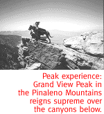
Infernal Rock Formations Are Heaven On Earth. By Kevin Franklin THE WORLD DROPS away from my feet, plummeting for a half-mile into Hell's Hole Creek. I'm in the heart of the Pinaleno Mountains, usually referred to as "Mount Graham," much like people call the Santa Catalinas "Mount Lemmon." This range is the silent giant of southeastern Arizona. At its highest, it crests 10,700 feet--nearly a 1,000 feet taller than any other peak in southern Arizona. The view from Grand View Peak is breathtaking, especially if you start to lose your balance on the steep granite. The drop is vertical for some distance. Off to the north runs the Gila River. To the northwest I can see the Santa Teresa Wilderness. But what captivates me most is the gorge below, dropping straight into Hell's Hole.
The late Ed Abbey would probably agree. In praise for the Canyonlands in The Journey Home, he writes: "The Canyon Country does not always inspire love. To many it appears barren, hostile, repellent. A fearsome land of rock and heat, sand dunes and quicksand, cactus, thornbush, scorpion, rattlesnake and agoraphobic distances. To those who see our land in that matter, the best reply is, 'Yes, you're right. It is a dangerous and terrible place. Enter at your own risk. Carry water. Avoid the noonday sun. Try to ignore the vultures. Pray frequently.' " From my vantage point on Grand View Peak, I can see down into the secret bends and corners of Hell's Hole Creek. Lush trees and half-hidden pools taunt me in the distance. I don't have time to descend into the canyon today. Hell will have to wait. We back to the road and over to Chesley Flat, a small meadow about two miles west of the turn-off for Webb Peak. A plaque commemorates how Abner Chesley met Sarah Jane Blair here in these mountains, where they married and built a cabin in 1883. During the summer, they milked their dairy cows and made cheese. Their children would later leave the family business to work the sawmills that used to operate in the mountains. Today, the meadow is free from cows, cheese, and the whining noise of lumber against metal. A trail runs for 50 yards along the meadow's eastern flank before disappearing into the forest. We follow it down and toward Lefthand and Blair canyons. Thick stands of trees and an enclosed canopy block out the direct sunlight and give the trail a wonderfully dark and pastoral quality. A few patches of snow remain despite the warm weather.
From time to time we can see the valley bottom below, and a series of pools and small waterfalls. If we had a full day, an interesting loop would be to hike Trail 304 until it meets Trail 319 and loop around counter-clockwise up a stretch of Hell's Hole Canyon. As the sun is growing low in the sky, however, we retreat the way we came. With little-used Forest Service trails like these, it's generally best to keep your options open and not count on things on the map being easily found. "Potentially some of that stuff you see on the Forest Service map (last updated in 1976) will no longer exist as far as the Forest Service trail system is considered," Templin says. For me, that all but settles in my mind the need for a return trip. Little-used trails, towering mountains, cascading waterfalls--it'd be a hell of a trip.
Getting ThereThe Pinaleno Mountains are east of Willcox. Take Highway 191 north off I-10. Just before Safford, turn west onto Highway 366 (a.k.a. Swift Trail), and follow that up the mountain. This windy mountain road is not for anyone prone to motion sickness.
Mapage: The Safford and Santa Catalina Ranger District Forest
Service Maps, and the Webb Peak 7 1/2-minute topographical map,
will tell you everything you need to know.
|
 |


Home | Currents | City Week | Music | Review | Books | Cinema | Back Page | Archives
| © 1995-97 Tucson Weekly . Info Booth |
||
 Whenever I see the words "hell," "devil,"
or better yet "diablo" on a map, I know they're
bound to describe my kind of country. Maybe these places seemed
demonic to the ranchers and farmers who named them while dreaming
of rolling grasslands; but to me, they're the last vestiges of
paradise. Those stereotypical depictions of hell, full of strange
rock formations and treacherous canyons, always seem far more
interesting than their heavenly, puffy-cloud counterparts. Hell's
a place for people who enjoy a good time.
Whenever I see the words "hell," "devil,"
or better yet "diablo" on a map, I know they're
bound to describe my kind of country. Maybe these places seemed
demonic to the ranchers and farmers who named them while dreaming
of rolling grasslands; but to me, they're the last vestiges of
paradise. Those stereotypical depictions of hell, full of strange
rock formations and treacherous canyons, always seem far more
interesting than their heavenly, puffy-cloud counterparts. Hell's
a place for people who enjoy a good time.
 When we come to an intersection, a sign post indicates the trail
to the right leads to Webb Peak. We continue downhill and to the
left. The Forest Service calls this Trail 304. In several places,
the anemic path requires a little reconnaissance to stay on course.
"Depending on our (annual) trail funding, different priorities
are set on what gets done in a given year," says Carrie Templin,
Forest Service recreation and public affairs specialist. "So
everything gets maintained over the course of a number of years,
but there is not a set schedule that says every three years such-and-such
trail will be maintained. We try to catch all of them as often
as we can."
When we come to an intersection, a sign post indicates the trail
to the right leads to Webb Peak. We continue downhill and to the
left. The Forest Service calls this Trail 304. In several places,
the anemic path requires a little reconnaissance to stay on course.
"Depending on our (annual) trail funding, different priorities
are set on what gets done in a given year," says Carrie Templin,
Forest Service recreation and public affairs specialist. "So
everything gets maintained over the course of a number of years,
but there is not a set schedule that says every three years such-and-such
trail will be maintained. We try to catch all of them as often
as we can."