

WHEN THE MAP said Copper Creek, I didn't think they meant it literally.
Copper Creek crosses the old dirt road I'm walking along and, sure enough, the water and rocks have a rusty color to them. With a little imagination they could seem almost coppery. Obviously, the heavy mineral concentrations around this old mining camp are being leached out by runoff and draining down into this creek. A glass of this stuff a day would treat anybody's anemia.
This Saturday I'm tagging along with University of Arizona Society of Earth Science students. They're exploring the remains of the Bunker Hill mining district surrounding Copper Creek in the Galiuro Mountains 50 miles northeast of Tucson.
The first mining in this rugged country started in 1863, back in the days when good mining advice was to dig with one hand and hold your rifle with the other. This was Apache country back then and, with the Civil War on, there wasn't much help a handful of miners could count on. One can only imagine the smile on an Apache warrior's face as he looked down on some miner who was staring intently at the ground, with good equipment and a couple of nice horses next to him. Well, if you can't take the heat, stay out of your neighbor's kitchen.
 Those first miners were unearthing lead and silver, but before
long copper became king, records a 1978 Arizona Geological Survey
bulletin by geologists J.O. Guthrie and D. G. Moore. With the
formation of the Bunk Hill mining district in 1883, wholesale
exploitation of the area could begin in earnest. Wandering around
the criss-crossed network of roads and mine openings, it becomes
clear this location turned out to be a pretty good spot to dig
holes. Today it makes a fine location to scour tailings piles
in search of the occasional mineral specimen.
Those first miners were unearthing lead and silver, but before
long copper became king, records a 1978 Arizona Geological Survey
bulletin by geologists J.O. Guthrie and D. G. Moore. With the
formation of the Bunk Hill mining district in 1883, wholesale
exploitation of the area could begin in earnest. Wandering around
the criss-crossed network of roads and mine openings, it becomes
clear this location turned out to be a pretty good spot to dig
holes. Today it makes a fine location to scour tailings piles
in search of the occasional mineral specimen.
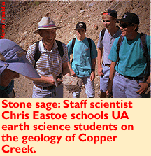
But before we do that, we need to learn the lay of the land. Chris Eastoe, UA geology department staff scientist, is along on the trip to help interpret the geology for students and hangers-on such as myself.
The primary draw for copper miners in these parts was a phenomenon known as "breccia pipe." Basically, breccia is rock made up of smaller rocks broken at sharp angles and then cemented together by some natural process. Imagine dropping a vase and then randomly gluing together the busted pieces on the floor.
These breccia pipes are columnar collections ranging from a few tens of feet to over 600 feet wide and descending as deep as 3,000 feet into the Earth's crust, according to Guthrie and Moore. All this busted-up rock makes easy passage for super-hot water solutions boiling around in the crust to work their way up. As these solutions move through the rocks, they deposit some of their dissolved minerals along the way, sort of like how CAP water leaves piles of crud in your hot water heater.
The result gets Indians kicked off their land, white men shooting each other and robber-barons salivating. After the mines have played out, and all that remains is the occasional shiny mineral on the rock piles, geology students emerge. Like coyotes scampering through a dump, we rock hounds scour the tailings in search of more rocks to fill our houses.
Currently, this land is owned by the Magma Mining Company. In most places surface minerals outside closed mines are fair game for collectors, unless otherwise posted.
Recently Magma has bulldozed a few of the mine shafts in order to keep the occasional idiot from killing himself there.
I hate that kind of thing. If you can get up in the morning and tie your shoelaces without help, you should be responsible for your own actions, especially around old mine shafts. Shafts near residential areas or, good grief, school yards are one thing. No one argues against filling those up. But if you can get all the way out here, then you should be accountable to get yourself back. To me old mines are history and--in more than a few cases--good bat habitat. It's a shame to see them go.
However, there's always a silver lining, so to speak. Recent bulldozing around here has turned over a lot of new material, and the previously picked-over roads and tailings piles produced some excellent specimens of quartz crystals, pyrite, chrysocolla and chalcopyrite.
At some points the road itself is covered in a powdery layer of dissolving golden pyrite--follow the yellow brick road....
Scrambling down one tailings pile, I tumble into an even more Oz-like scene. A river of green rocks, a vibrant MGM green, is flowing by. No water is in this wash, but the leaching of copper minerals has turned the river cobbles green. In one sense it has a sort of Superfund-site weirdness to it. But the quantity of mineralization here is unlikely to cause much biological harm, certainly less than another subdivision of cheapie homes, and it has an undeniably whimsical charm.
The geology club gathers around for a picture of this oddity and then, with a click of our Red Wing boots, we depart from this place of green and copper rivers and golden roads.